
Unmanned Aerial Vehicles (UAVs) have emerged as a force multiplier that has changed the course of warfare in recent years. The cost-effectiveness of operations, and the fact that they largely eliminate human casualties and collateral damage, have led to increased investment in UAV technologies. Türkiye is one of the world’s few major players in this field.
Sensor technologies are among the most important factors that increase the effectiveness of UAVs. Although electro-optical systems are the main sensor component of UAVs, conducting reconnaissance-surveillance operations in all weather conditions is only possible with the use of different modalities of sensors in conjunction with electro-optical systems. For this reason, in addition to electro-optical systems, radar systems that increase the continuity and effectiveness of the reconnaissance surveillance mission are also used in UAV systems that have come to the forefront with their performance in the world.
Thanks to their full performance in day and night conditions and limited performance losses in different meteorological conditions (cloudiness, fog, rain, snow, etc.), these radars enable UAV systems to operate 24/7 and in all weather conditions. As the most widely used radar type in UAVs, SAR radars are prominent.
SAR imaging is the process of creating a reflection map by integrating the reflections of radio signals sent from a radar on a moving platform. Unlike electro-optical systems, the reflection map is radiometrically rather than geometrically accurate. For this reason, it also carries information about the material properties of the reflected surface. The fact that it has a range-independent resolution and that conditions such as clouds, fog, and precipitation do not interfere with the radio signals used has enabled the technology to be used for many years. Significant progress has been made in image resolution with advancing technologies. SAR images, which were initially produced offline, can now be produced in near real-time. The fact that its resolution does not change between the minimum and maximum range values due to its technology also brings SAR imaging to the forefront in terms of its ability to access critical information at acceptable resolutions from safe distances. As this accelerates intelligence production processes, the use of SAR imaging has become quite widespread. According to statistics, more than half of the year in Türkiye’s geography is cloudy with varying degrees of intensity. This situation necessitates the use of sensors of different modalities such as radar in addition to EO/IR payloads for reconnaissance surveillance.
Read More: Turkey’s Ratinar AESA Radar Ready for Operation
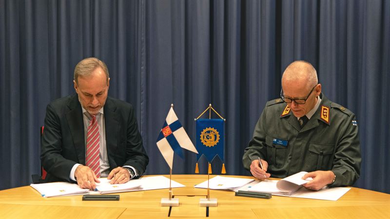
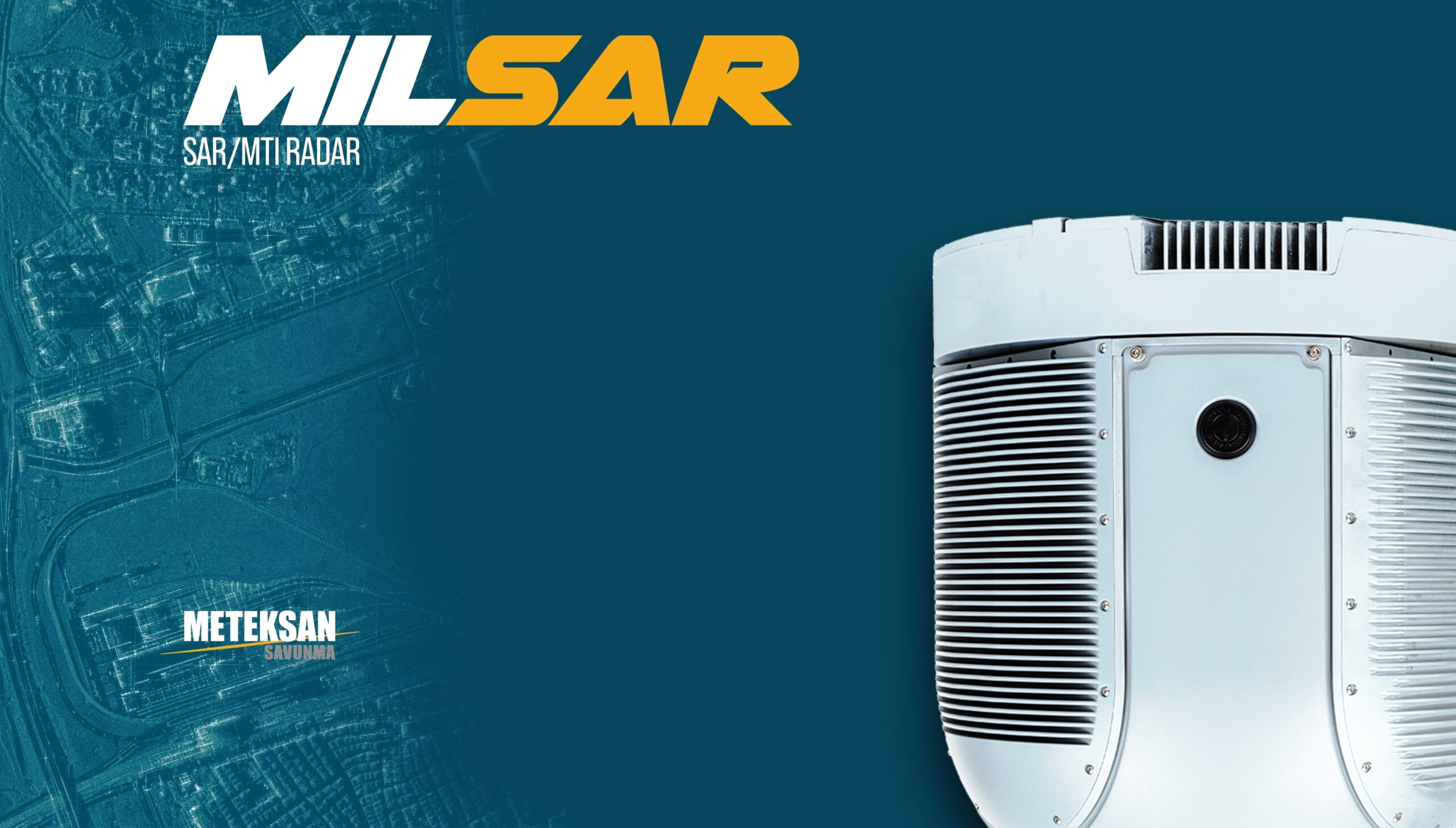
In parallel with the significant successes Türkiye has achieved in UAV technologies, it continues to develop indigenous technologies in the field of sensor systems and to strengthen its UAV platforms, which have achieved great success in the world market, with new sensors. The latest example of these technological developments and UAV radars is the MILSAR SAR/MTI Radar, designed and produced by Meteksan Defence within the scope of the Turkish Defence Agency (SSB) project.
MILSAR, Synthetic Aperture Radar (SAR), and Moving Target Indicator (MTI) radar, can continue to provide high-resolution images in weather conditions where electro-optical sensors are ineffective. With MILSAR, UAVs can scan a wider area for reconnaissance-surveillance purposes in much shorter periods of time.
Wide Area And High-Resolution Focused Imaging:
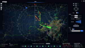
With its SAR feature, MILSAR creates high-resolution images independent of range. Like other SAR systems, MILSAR can operate in strip or spot modes. In strip mode, the radar generates images with a resolution of 3 m, 1 m, 0.5 m and presents them to the operator as smoothly as a video image. The bandwidth required to transmit the images to the ground station is compatible with existing UAV data links. When Meteksan Defence AKSON C-Band Data Link is used, the bandwidth that can be allocated increases even more. In Strip mode, the radar can scan a wide area for reconnaissance purposes, while in Spot mode, it can provide surveillance images with a resolution of up to 30 centimeters, regardless of range, even in conditions where there is no visibility. MMTI and ISAR capabilities facilitate the operators to detect and identify the surface vessels at sea. GMTI feature of MILSAR comes into play when tracking ground-moving targets. In a broad sense, MTI can be considered as a radar function that reflects the instantaneously changing characteristics of the operational environment in real-time. When combined with EO/IR systems used for positive identification and with high-precision missiles having weather-independent precision guidance, MTI becomes a significant force multiplier.
Easy Installation Feature:
Providing 360-degree awareness, MILSAR radar has low weight (under 30 kg), low power consumption, and low volume. As a result, it is capable of operating on all tactical and strategic level platforms, such as Bayraktar TB2, ANKA, Aksungur, and other UAVs. In addition, since it has the same mechanical interface as the standard 15-inch EO/IR sensor turret, the electro-optical payload can be easily removed and replaced with the MILSAR in minutes. MILSAR’s compact structure and compatibility with the size and weight of existing electro-optical sensors also greatly facilitate the integration of the radar into different UAVs.

MILSAR radar, which has all these advanced technology features, was recently recognized by the public for its success in detecting drifting mines in the Black Sea as a result of the Ukraine-Russia War. MILSAR, whose engineering tests were carried out on the ANKA platform, had to be operationally deployed in the field before the R&D approval processes were completed and emerged as one of the rare R&D products with the design maturity to accomplish this mission. Within the scope of the mission, AKSUNGUR was integrated into the UAV in a short time, and unlike ANKA, it was used with an EO/IR camera. Although there is no known application in open sources for the detection of drifting sea mines with SAR technology, the rapid adaptation of the developed technology to a newly emerging problem was possible through original engineering studies. For the final solution to the problem, the selection of a platform (AKSUNGUR) that can carry MILSAR and EO/IR cameras at the same time made the solution much more effective, and it was possible to identify the mines detected by MILSAR with the EO/IR camera. This problem and its solution demonstrated that the use of sensors in synergy with each other, rather than competing with each other, can lead to a significant increase in reconnaissance surveillance capabilities. Currently, AKSUNGUR UCAVs in the Turkish Naval Forces inventory continue to fly with MILSAR radar.

MILSAR radar, which can have a wide range of uses in terms of military intelligence, also offers the opportunity to be used in the fight against forest fires. With its capabilities, it can also be used effectively in monitoring and analyzing the course of the fire in night conditions, when fire-fighting activities are restricted, and in post-fire damage assessment. Meteksan Savunma, who continues to work continuously to further increase the capabilities of the radar, is also working on the “Change Detection” feature. This feature is used to compare previously taken images with current images and to reveal changes with artificial intelligence. Thus, for example, the presence of improvised explosive devices (IEDs) planted by terrorists can be detected. Meteksan Defence foresees that MILSAR, which can detect 1,000 moving targets simultaneously with 360-degree coverage, and track 200 moving targets with position, speed, and direction information, will soon be used much more in UAV platforms.
Key Features And Benefits:
- Multi-mode Airborne Radar
- Compact and Lightweight
- Protection of Land and Sea Borders
- All Weather Wide Area Surveillance
- High-Resolution Radar Imaging
- Selectable Image Resolutions
- High-Resolution Monopulse Tracking
- ITAR-Free
Potential Usage of MILSAR with Pakistan UAV Platforms:
Pakistan has developed multiple UAVs including Shahpar-1 & Shahpar-2 UAVs. Due to its compact size and low power consumption, MILSAR radar can be easily integrated with the Shahpar series UAVs. Integration of MILSAR with these UAVs has multiple advantages as compared to other competitors since MILSAR is a combat-proven system and widely operational with UAVs in the Turkish Armed Forces. The integration of MILSAR with Shahpar series drones will enable the Pakistan Armed Forces to conduct surveillance & precision strike operations. This advanced radar system enables effective reconnaissance, target identification, and tracking of moving objects all of which are needed by the Shahpar drone as these drones are employed for intelligence, surveillance, and reconnaissance (ISR) missions along the country’s borders, particularly in border management and monitoring activities.