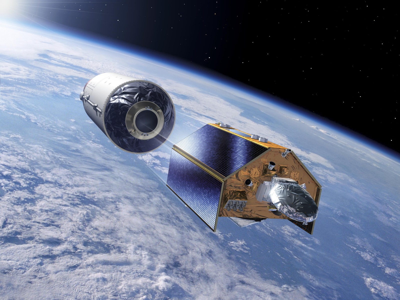

The Sentinel-6B climate satellite, built by Airbus, successfully launched on 17 November 2025 from Vandenberg Space Force Base in California. Sentinel-6B is the second of two identical satellites designed to deliver long-term, high-accuracy measurements of global sea-surface height, ocean circulation, and atmospheric conditions. The first satellite in the series, Sentinel-6 Michael Freilich, was launched in 2020.
For its first year in orbit, Sentinel-6B will operate alongside Sentinel-6 Michael Freilich to create overlapping datasets. This dual-satellite phase ensures continuity in measurement accuracy—essential for tracking sea-level rise, improving ocean weather forecasts, and helping coastal states anticipate long-term climate impacts.
Mission Role and Scientific Value
Airbus says the mission plays a central role in maintaining reliable sea-level records. Alain Fauré, Head of Space Systems at Airbus, noted that precise measurements are vital for climate analysis:
“Accurate sea-level measurements are invaluable data to help protect coastal communities and guide global climate action.”
Sentinel-6B uses high-precision radar altimetry, sending radar signals to the ocean surface and measuring return time with centimetre-level accuracy. The satellite also gathers atmospheric temperature and humidity profiles, contributing to improved weather modelling and climate trend analysis.
Technical Features and Orbit Profile
The satellite weighs about 1.3 tons and operates in a 1,336-km non–Sun-synchronous orbit with a 66-degree inclination. This orbital design allows the spacecraft to pass over different global locations at varying times throughout the day, helping detect changes influenced by tides and regional climate behaviour.
Sentinel-6B supports long-term ocean monitoring and ensures the continuation of nearly three decades of sea-level observations, a dataset considered foundational for evaluating the pace of global warming and ocean expansion.
Part of the EU Copernicus Climate Programme
Sentinel-6B is part of the European Union’s Copernicus Programme, the world’s largest Earth-observation initiative. While the mission is European, it is the result of wide international collaboration.
It has been jointly developed by:
with support from CNES, under Airbus’ industrial leadership.
Airbus has now delivered more than twenty climate-monitoring satellites as prime contractor, contributing significantly to global environmental and climate-research networks.
Why Sentinel-6B Matters
The launch of Sentinel-6B supports several global priorities:
-
Ensuring accurate sea-level rise tracking
-
Improving coastal risk assessments
-
Supporting climate-resilient policy planning
-
Enhancing weather and ocean forecasting models
-
Maintaining uninterrupted long-term climate datasets
As sea levels continue to rise at an accelerated pace, the continuity provided by the Sentinel-6 mission is considered essential for future climate adaptation strategies.