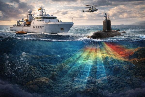

The center of gravity of naval activities in the present epoch has been gradually shifting from the high seas to the littorals. This made acquiring advanced knowledge of the littoral sub-surface environment indispensable for both surface and sub-surface maritime vessel operations. Information about the littoral environment is crucial for naval commanders, as the underwater world is complex and full of mysteries. Here is the utility of survey ships, which provide the data required by operational commanders for planning naval operations.
The latest induction of the INS Ikshak is an effort by the Indian Navy to equip its fleet with advanced next-generation survey vessels. The article argues that INS Ikshak will enable the Navy to create precise maps of underwater navigation channels, allowing its submerged fleet to operate through hidden channels and making its detection challenging for Pakistan’s naval assets.
The surveys provide critical data on seabed depth; they are used to formulate navigational charts for civilian and military ships and to assist in searching for sea mines and sunken ships. Moreover, it serves to ensure that maritime transport network operates in a manner that is both safe and effective by providing detailed maps of water depth, the contours of the seabed and shoreline, the locations of potential obstacles, and the physical characteristics of bodies of water
Besides, the presence of precise maps is vital for formulation of offensive or defensive naval operations, construction of harbors, safe sailing of ships and submarines, development of infrastructure on littorals shores, delimitation and enforcement of national maritime boundaries, and exploration of resources beneath water.
Nowadays, most hydrographic data is collected using multibeam echo sounder technology. As the ship moves over the surveyed region, the multi-beam acoustic sounder beams scan the seafloor. Echo sounder beams from a multiband system bounce off the ocean floor and then return to the ship, determining the depth. In addition to ensure accurate positioning of each depth measurement, MBES data are integrated with high-precision GPS, motion sensors (to correct for roll, pitch, and heave), and sound velocity profiles of the water column. The result is a dense, high-resolution three-dimensional representation of the seafloor, which is essential for navigation safety, coastal zone management, seabed mapping, and scientific research.
The maps generated during peacetime will help the Indian Navy’s new anti-submarine warfare corvettes, and other similar vessels, which are designed to operate specifically along the littorals of the Southern Arabian Sea, along with submarines, conduct their missions effectively during conflicts. Precise maps of the ocean seabed will facilitate submarine operations, enabling navigation through hidden passages and thereby avoiding detection by the adversary. In short, this unarmed vessel, along with other ships of the class, brings unparalleled resourcefulness and capability to the Indian Navy’s hydrographic fleet.
The induction of advanced survey vessels into the Indian Navy has important strategic and operational implications for Pakistan, particularly in the maritime domain of the Arabian Sea. While the vessel itself is unarmed and ostensibly designed for hydrographic and navigational purposes, the data it generates has clear military relevance. For Pakistan, this development reinforces existing asymmetries in maritime awareness and undersea domain knowledge between the two navies.
For instance, Improved seabed mapping contributes to more effective mine warfare and counter-mine operations. From Pakistan’s perspective, this has dual implications. On one hand, Indian maritime forces would be better equipped to detect, avoid, or neutralize defensive minefields. On the other hand, their ability to deploy mines in strategically significant areas would be enhanced by accurate knowledge of seabed depth and composition.
In addition, presence of modern survey vessels underscores India’s broader push toward persistent maritime domain awareness in the Northern Indian Ocean. Survey data feeds into a wider network of naval intelligence, surveillance, and reconnaissance assets. For Pakistan, this means that Indian naval operations in the Arabian Sea are likely to become more coordinated, predictable for India itself, yet harder for adversaries to anticipate.
There are geopolitical and legal dimensions. Hydrographic data supports claims related to maritime boundary delimitation, continental shelf submissions, and resource exploration. As India enhances its technical capacity in this area, Pakistan may feel pressure to strengthen its own hydrographic institutions to ensure it can effectively safeguard its maritime rights and interests.
Conclusively, the induction of vessels like INS Ikshak may affect Pakistan’s naval modernization priorities. Rather than matching India ship-for-ship, Pakistan may seek asymmetric responses, such as investing in improved coastal surveillance, and passive acoustic sensors. While survey vessels are not combat platforms, their contribution to undersea knowledge directly affects naval balance and crisis dynamics. For Pakistan, India’s growing hydrographic capability represents a subtle but significant shift in the maritime environment, one that requires strategic assessment, capability, and sustained investment in maritime awareness.

Tayyaba Khurshid is currently serving as Research Officer at Center for International Strategic Studies, AJK. She holds an MPhil degree in International Relations from Quaid-e-Azam University, Islamabad and Bachelors in IR from National Defense University. She is member of Emerging Voices Network BASIC UK, a NESA Alumnus and a 2024 Gaming for Peace fellow. Her areas of interest are arms control and disarmament, emerging and disruptive technologies and impact on nuclear deterrence and Great power competition. She has presented her research work at multiple national and international conferences. Her written work spans peer-reviewed journals, book chapter, and opinion pieces in reputed platforms. She also serves as Director Outreach and leads digital content initiatives for CISS, AJK. She can be reached at tayaba.khan127@gmail.com