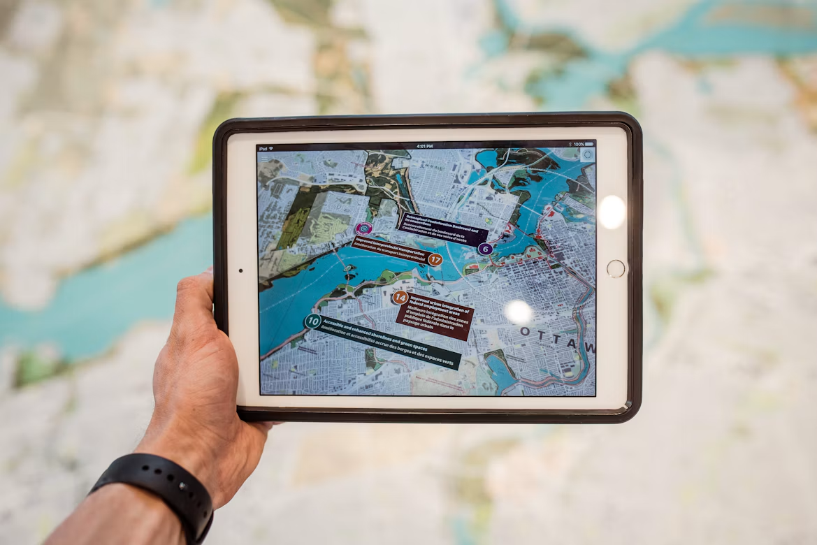

It’s nothing short of marvelous to be alive at a time when satellites exist. They are capable of capturing information about our changing world, from expanding cities to extreme weather.
As of 2026, an estimated 31,449 tracked objects can be found in Earth’s orbit. Out of these, at least 18,696 are satellites in the everyday sense. There is no telling the volume of information all of these combined can extract.
However, the real challenge lies in processing those vast volumes of imagery and turning them into insights that support timely decisions. Artificial Intelligence (AI) is helping address this challenge, and its role extends beyond ground-based analysis.
Besides converting raw satellite imagery into useful insights, AI is also making space data more accessible. This article explores five ways in which this technology is reshaping how we understand and use information gathered from space.
Table of Contents
ToggleAccelerated Data Processing Speed
As stated earlier, collecting gargantuan volumes of Earth data is just the beginning. Analysts also need to identify relevant locations, assess image quality, and determine which datasets can answer their questions.
Satellite AI streamlines this process by automating tasks such as image classification and pattern recognition. Beyond data processing, AI can simplify finding suitable satellite imagery in the first place. For instance, Rowan is an AI-powered assistant that demonstrates this through a conversational interface designed to explore satellite data.
Users need not navigate complex catalogs or understand every technical specification in advance. SkyFi explains that one does not need to start with a satellite, sensor, resolution, or product name. This approach makes satellite imagery discovery more intuitive.
So, someone investigating changes around a point could describe the location and timeframe of interest instead of technical parameters. Rowan will then help users explore available imagery and compare suitable options. This is just an example; AI can accelerate several stages of satellite data processing, as follows:
- AI models can categorise images based on features such as vegetation, buildings, roads, water bodies, etc., for faster access to details.
- Systems can identify cloud cover and other image-quality issues, which makes it easier to find observations.
- AI can identify objects and geographical features within large image collections, thereby reducing the need for manual inspection.
- AI-assisted workflows can narrow down large datasets to imagery that best matches a particular location or analytical requirement.
Detection of Changes Across the Earth’s Surface
Satellite imagery does provide a record of how the Earth’s surface changes over time, be it urban expansion or deforestation. What’s challenging is identifying these changes across images captured on different dates.
This is especially true of large regions. AI is reshaping this process by helping analyze satellite observations and map affected areas more efficiently. AI-powered change detection can support several applications, including:
- Comparing satellite images from different dates to identify new buildings or changes in land use
- Flagging areas where tree cover has declined to help with closer investigation
- Analyzing imagery captured before and after floods or wildfires to estimate the extent of affected areas
- Assessing changes in vegetation cover to help researchers monitor crops
NASA’s Prithvi Geospatial AI model is a case in point of how this capability is advancing. According to a 2026 report, Prithvi was trained on 13 years of Earth-observation data. It was aboard two in-orbit platforms: Australia’s Kalyani satellite and an imaging payload aboard the International Space Station.
This is significant because Prithvi is a geospatial foundation model that can be adapted for different Earth-observation tasks. The model’s open availability helps researchers build on existing AI capabilities.
Dr. Andrew Du, the project’s lead researcher, explained, “If Prithvi weren’t open source, I would have to train my own foundation model. Having that model openly available saved a lot of time and effort.” Here, we see how open-source AI models are aiding the development of new applications for satellite observations (without a lot of time and effort).
Stronger Space-Based Intelligence and Surveillance
Defense and intelligence organizations use satellite imagery to monitor locations and understand activity across difficult areas. The growing volume of imagery makes it challenging to examine every observation closely.
AI has stepped in, helping detect objects, flag unusual activity, and prioritize information requiring close attention. The following tasks are well-supported by AI-assisted intelligence systems:
- Computer vision models classify features like vehicles, ships, and buildings to help locate relevant objects.
- Observations that differ from expected patterns are flagged to direct attention where it matters most.
- By analyzing repeated observations alongside other intelligence data, AI helps analysts understand how activity at a location is changing.
- Automated detection and prioritization are reducing the time required to find and deliver relevant information to decision-makers.
In a recent report, Defense One described how the National Geospatial-Intelligence Agency (NGA) was expanding its use of AI through its Maven program. The system helps analyze satellite and other data to identify potential targets.
According to the report, the time between an object appearing and being detected as a potential target had decreased by 80%. Not only can AI systems identify known objects, but they can also spot unexpected or unusual changes. This is what makes AI useful for turning large volumes of space-based observations into timely intelligence.
Better Environmental Insights
Weather conditions and oceanic factors seldom stay static. Even after receiving satellite images of the changes, forecasting is not so easy. Scientists need to interpret complex patterns and incorporate them into prediction models.
Again, AI is saving the day by helping scientists analyze such patterns. How exactly? Mainly through improved environmental data used in prediction models. Let’s take a closer look at the several ways in which AI supports this work:
- Atmospheric measurements are analyzed to identify patterns associated with developing storms.
- Changes in vegetation, drought conditions, and ocean patterns are tracked over time.
- Satellites get the help they need to direct instruments towards developing storms or wildfires for more useful observations.
- Ionospheric measurements are also analyzed to help monitor conditions that affect satellite operations/communications.
Recent investment by the US National Oceanic and Atmospheric Administration (NOAA) highlights the importance of reliable satellite observations. In September, 2026, NOAA announced $67.05 million in contracts over two years to acquire commercial satellite data.
This included 10,000 atmospheric radio-occultation profiles and 500 ionospheric measurements per day. These observations will support operational weather forecasting and space-weather applications.
This investment may not be a direct measure of AI’s forecasting accuracy. However, the importance of high-quality satellite data is clear from it. Forecasts still depend on data quality and model performance, but such advances are making space data more useful for potential developments.
More Accessible and Actionable Space Data
Satellite data becomes more valuable when organizations can access it, understand its limitations, and apply it to real decisions. However, commercial services can involve licensing costs, usage restrictions, and uncertainty about long-term access.
AI can help make data easier to interpret and integrate into existing workflows. However, accessibility also depends on whether organizations can obtain and use the data in the first place. AI can help turn satellite observations into practical outputs in the following ways:
- Usable insights: Convert complex geospatial data into indicators, maps, and summaries that support decision-making.
- Information sources: Help organizations combine satellite-derived insights with operational records and other location-based data.
- Better prioritization: Use geospatial indicators to identify locations that may need inspections, resources, or further investigation.
- Simplified communication: Present analytical findings in formats that non-specialists can understand and use.
A March 2026 CBS News report highlighted the story of commercial satellite provider Planet Labs. The company delayed releasing new imagery of Iran, the Persian Gulf, and other conflict zones for 14 days. It cited concerns that the imagery could be exploited by adversaries.
The report also explained how satellite images have helped journalists document destruction and investigate events in areas difficult to access on the ground. This example shows that making space data actionable is not just about improving AI tools. Users should be able to extract meaningful information from accessible data, which can later be used based on responsible data-sharing policies.
FAQs
How does AI help turn satellite imagery into useful information?
AI automates image classification, detects changes over time, and helps analysts prioritize relevant observations. These capabilities make it easier to transform large volumes of satellite imagery into insights for environmental monitoring, defense intelligence, and operational decision-making.
Can AI predict natural disasters using satellite data?
AI can analyze satellite observations and environmental measurements to identify patterns associated with developing storms, floods, etc. It supports forecasting and disaster assessment, but predictions depend on data quality, model performance, and scientific validation.
What challenges limit the use of satellite data?
Key challenges include complex data processing, limited technical expertise, image quality issues, and licensing costs. AI can simplify analysis and interpretation, but reliable results also require suitable observations and responsible data policies.
How AI Turns Satellite Data Into Real-World Value
| Application | What AI Makes Possible |
| Agriculture | Monitor crop conditions and identify areas needing closer inspection. |
| Urban planning | Map infrastructure growth and assess changing land use. |
| Disaster response | Estimate flood damage and identify wildfire-affected areas. |
| Defense intelligence | Detect objects and flag unusual activity for review. |
| Weather forecasting | Analyze atmospheric observations to support prediction models. |
| Environmental research | Track vegetation changes and monitor ecosystem conditions. |
| Commercial operations | Turn geospatial observations into insights for planning and resource allocation. |
Artificial Intelligence is truly changing the value of satellite data. This is clear from the steady rise in demand for location-based insights. According to Grand View Research, the global geospatial imagery analytics market is projected to grow from $13.6 billion in 2025 to $28.7 billion by 2033.
Ultimately, the real value of this technology lies not in the volume of satellite data collected. It is in how effectively that data helps people understand change, anticipate challenges, and make informed decisions. AI will help unlock that potential, provided its outputs are validated and interpreted in context.